Malvern, PA
Precision Drone Mapping for Renewable Energy Planning
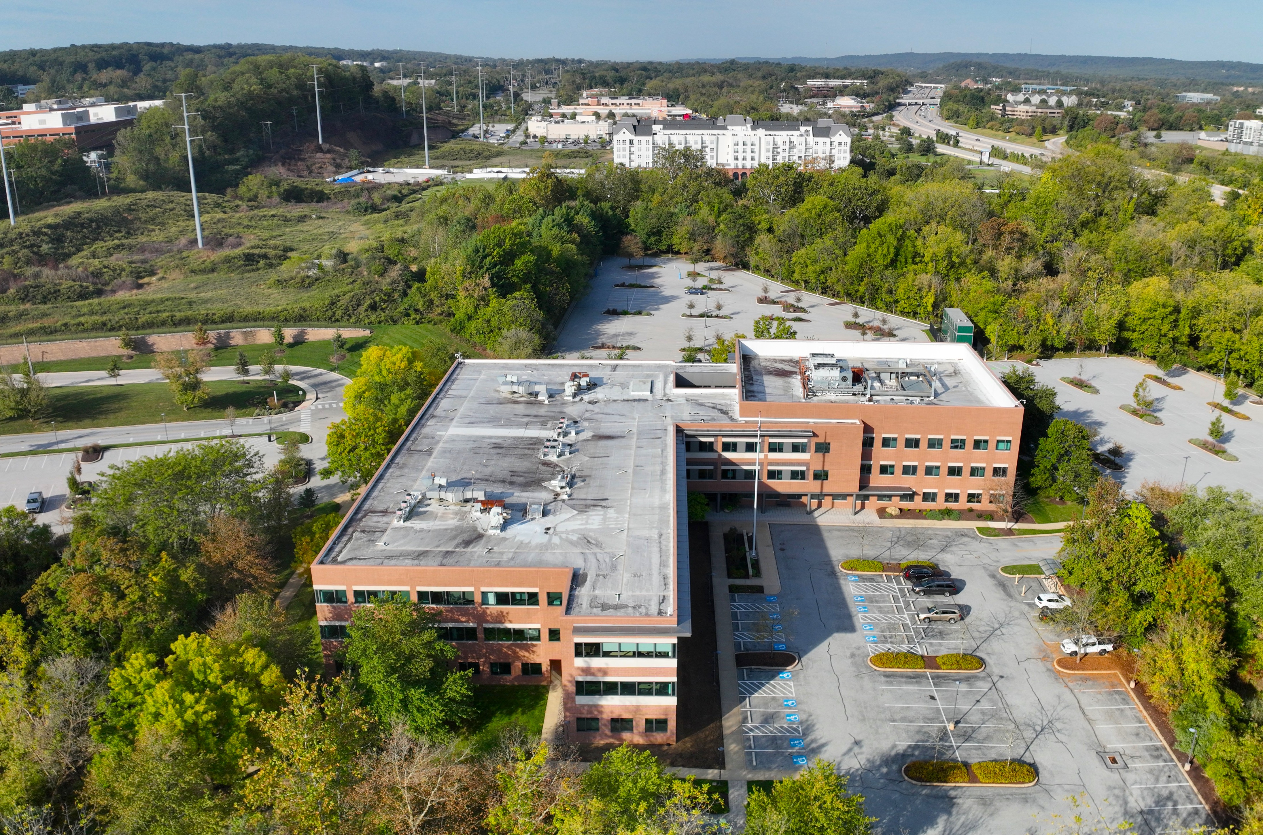
A commercial facility located in Malvern, Pennsylvania initiated a rooftop solar installation project as part of its broader sustainability strategy. To support the engineering and planning phase, a drone-based photogrammetry mapping was commissioned to evaluate the roof's structural layout, shading conditions, and usable surface area.
The objective was to deliver high-resolution aerial imagery and a detailed 3D model to assist solar engineers in optimizing panel placement and system design.
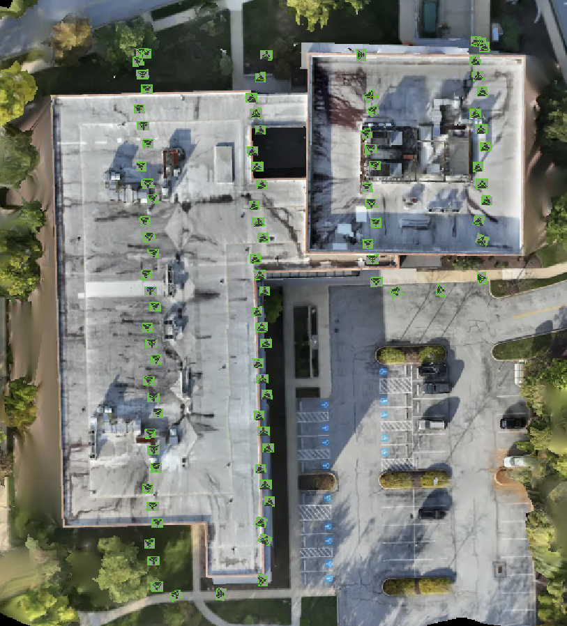
The mapping was conducted using a DJI Matrice 4E drone, configured for precision grid flight and autonomous execution via DroneDeploy. The flight path was designed to maximize coverage with 80% overlap, ensuring photogrammetric accuracy across the entire rooftop.
To enhance the quality of 3D reconstruction, the Smart Oblique 3D Capture functionality was utilized. This feature enabled the drone to automatically adjust camera angles during flight, capturing oblique imagery from multiple perspectives. The resulting dataset provided a highly realistic and dimensionally accurate 3D model—ideal for analyzing parapet walls, HVAC units, and elevation changes.
The mission covered approximately 12,000 sq ft and captured 220 geotagged images under optimal weather conditions, with clear skies and minimal wind.
| Component | Specification |
|---|---|
| Drone | DJI Matrice 4E |
| Flight Software | DroneDeploy (mission planning & control) |
| Capture Mode | Smart Oblique 3D Capture |
| Processing Tools | DroneDeploy, Pix4D Mapper |
Drone photogrammetry provided significant advantages over traditional rooftop mapping methods:
| Benefit | Drone Photogrammetry | Traditional Methods |
|---|---|---|
| Speed | Full mapping completed in under 20 minutes | Several hours or days of manual work |
| Safety | No rooftop access required | Requires climbing and safety gear |
| Accuracy | Centimeter-level geospatial precision | Manual measurements prone to error |
| Coverage | Entire rooftop captured in high-res imagery | Limited by human access and visibility |
| Data Richness | Orthomosaic, 3D model, DSM, annotations | Basic sketches and photos |
| Turnaround Time | Deliverables ready within 24 hours | Often takes multiple days |
The Smart Oblique 3D Capture feature further enhanced the model's realism and dimensional accuracy—an essential advantage for solar engineering teams requiring precise elevation and obstruction data.
The aerial mapping enabled the solar engineering team to finalize panel layout with confidence. The data supported efficient planning, reduced the need for manual inspections, and accelerated the project timeline.
This project demonstrates the value of drone photogrammetry in renewable energy planning. The mapping team delivered high-quality data safely and efficiently, helping stakeholders in Malvern take a meaningful step toward sustainable infrastructure.